Precise Positioning
Precision Agriculture
Precision agriculture applications such as row crop bed preparation, planting, and advanced irrigation techniques require centimeter-level solutions using Real-Time Kinematic (RTK) GNSS positioning that give greater accuracy, as well as huge savings in time and money.
Precision agriculture first requires the mapping of fields using a mobile GPS data collection system. The highest accuracy will be found in an RTK survey-grade receiver collecting the information. Coordinates are calculated by the GPS surveying system and transmitted by radio to the collection and analyzing station. The boundaries and desired pathways are determined from this data.
Precision agriculture takes the mapping data and charts the guidance parameters, which tell the tractor or sprinkler system where to travel. Data is transmitted that tracks the exact location of the equipment which is following the predetermined coordinates of the field. Collected information may be used to more precisely evaluate optimum sowing density, estimate fertilizer and pesticide concentrations, and ensure watering systems accurately water every inch of the field and no more. Precision agriculture offers the opportunity for more profitable and environmentally sensitive farming.
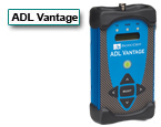
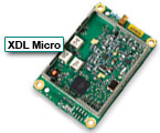
Pacific Crest offers a precision agriculture solution with wireless data links mounted in strategic locations for mapping and guidance systems.
![]() Precision Agriculture (English)
Precision Agriculture (English)


